
Dingwall Station
Online version of display created in 2012, as part of the Heritage Along the Kyle Line project. Note that due to copyright restrictions, some images in the original display have not been reproduced here.
Introduction
Dingwall Station opened on 11 June 1862. In the 150 years it has been in use, the station has seen a number of changes. These two maps depict the station in 1873 and in 1904. The growth in the station can clearly be seen, including sidings and waiting area for the Strathpeffer branch line (which opened in 1885). The original station on the first map was replaced by the current stone building with its ornate finials and useful date lintel recording 1886. Over the years thousands of passengers have passed through the station, but also large numbers of livestock and fish.
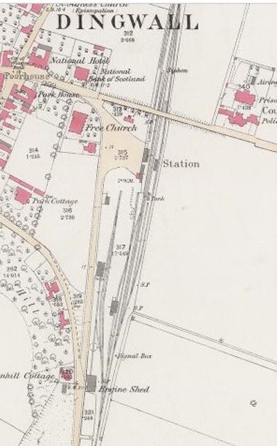
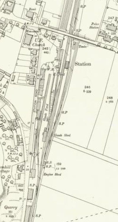
Many changes have occurred in the last 150 years. The station is a much smaller affair now, with only a keen eye able to see where sidings formerly stood. The engine shed and turntable have been replaced by housing. Both signal boxes are gone. The last remains of the weighbridge and coal yard are only just visible. Some structures have moved, including the old Strathpeffer waiting room. A crane now lies abandoned on its side near the footbridge. Shops have come and gone, with none currently (2025) filled. New workshops are now on the east side.
This display shows photos of some of the remains still be seen of Dingwall Station and pictures from the past.
The Station
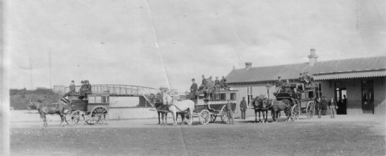 This early picture shows the first station, before the rebuilding of 1886. © Dingwall Museum
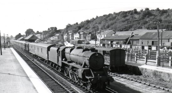
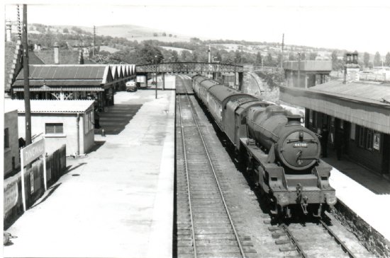 Dingwall Station 1955. Note the buildings on the left, now demolished, and the two water tanks.
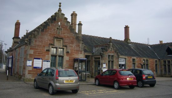
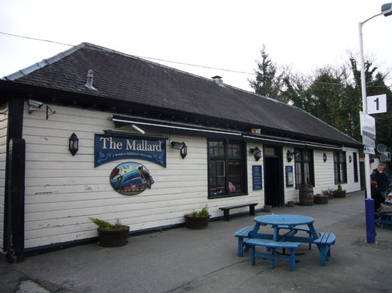
The present station dates to 1886. Note the unusual finials on the roof.
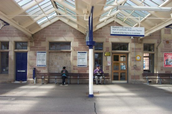
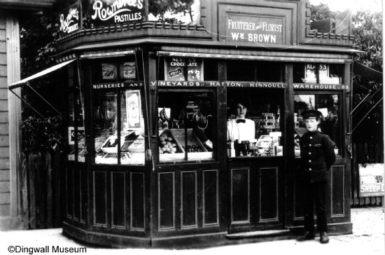
Platform 1 in 2012 The Menzies Kiosk, 1909-1010
Platforms and Sidings
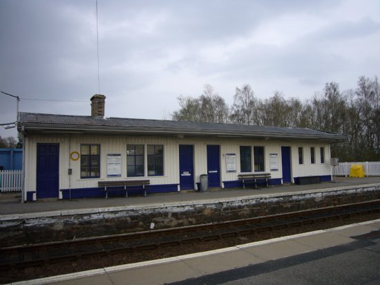
Waiting room on east side Sidings, date unknown
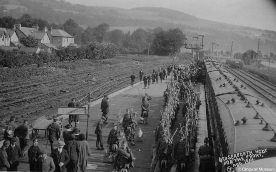
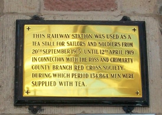
This picture was taken from the road bridge looking north at the Strathpeffer platform and sidings in 1914. The station was busy during the war, with the local Red Cross Society serving teas.
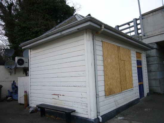
The Strathpeffer waiting room was originally on the north side of the bridge, but was moved to its current position, to the south of the bridge, where it is now in a much delapidated state. No building existed on the site of the Mallard when the first station was built, but by 1904 there was a building on the site.
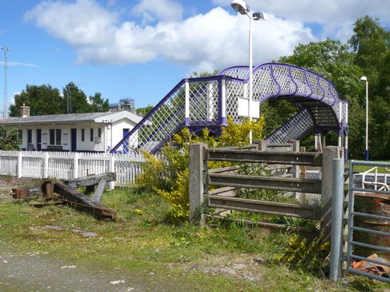
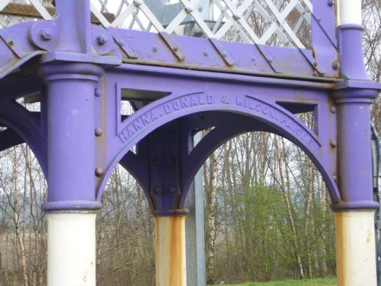
The footbridge was made by Paisley foundry Hanna, Donald & Wilson and probably dates to the original construction of the station.
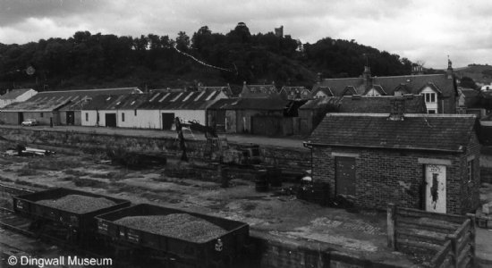
Goods Yard and Cattle Pens
The cleared area to the west of the footbridge was the entrance to the goods yard, and also to a number of buildings owned by railway customers. Nothing remains of the buildings in the former Goods yard.
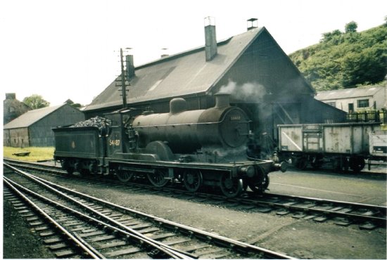
Dingwall Goods area, probably in the late 1950s/early 1960s. ©unknown.
Visible in the picture at the far end are the south signal box, engine shed, goods shed, and goods office with chimney. The shed behind the box van with the lorry may be Rowats Tea. Then there is the Esso Depot with Esso sign. Then Henderson’s, with a van in front and a crane. The line of coal wagons are being emptied into bags, and the empty bags are draped over the side of the wagon. The big building visible across the road beyond Henderson’s store is Robertson & Porter's Garage with its house attached to one end. To the right is a good view of the cattle pens and a cattle wagon.
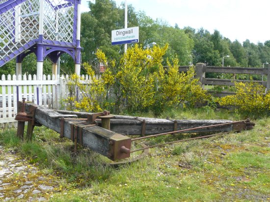
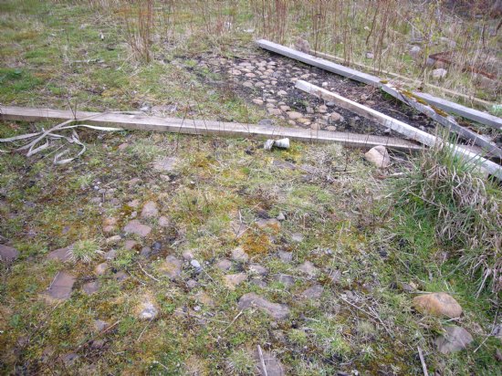
Left: Old photographs show a crane on the goods platform. The crane now lying near the footbridge was probably originally in the Goods Shed. Right: Coal yard remains in 2012. Much of the coal for Dingwall would have been imported by rail. In earlier times, coal was also needed for steam trains.
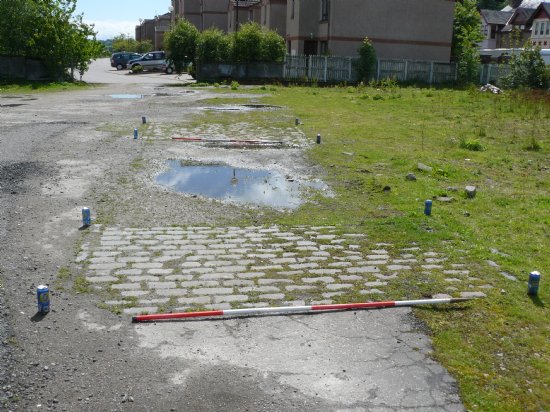
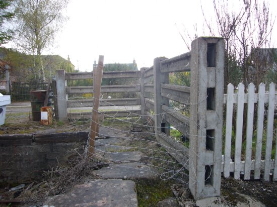
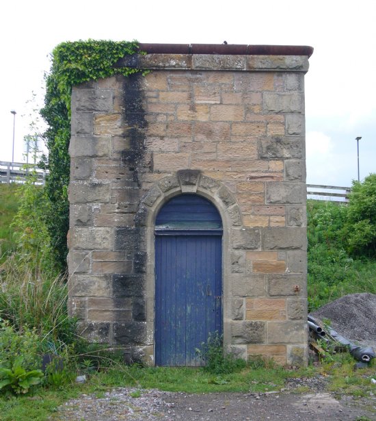
Left: Remains of weigh bridge used to weigh goods in and out of the yard. Right: Remains of heavy duty cattle fencing, used to pen catlle before tranport.
Signal Boxes, Turntable and Water Tank
Old photographs show signal boxes to the north and south of the station, but both have been demolished. Similarly, the turntable shown on the map has long disappeared.
Left: Engine shed from the 1960s, located opposite Greenhill Cottage. Both OS maps show a similar sized engine shed, suggesting that it may date to the original station.
Right: Base for water tower, used for steam trains. The 1st edition OS map shows the water tank to the south, but by 1905 it had moved near the road where the base still remains.
Latest News...
15/07/2026 - ARCH Digitising Highland Maps and Plans project - volunteers wanted!
Welcome Claire Boardman, our newly appointed project officer for the Digitish Highland Map... More >>
10/06/2026 - Wanted: project officer for ARCH Digitising Highland Maps and Plans project
ARCH is looking to recruit a project officer for The Digitisng Highland Maps and Plans pro... More >>
27/01/2026 - Highland Heritage Day 2026 - Booking form and timetable available
This year's Highland Heritage Day will take place on Saturday 14th March at Dingwall A... More >>
Site of the Month
 10/04/2021 - Easter Raitts township
Easter Raitts township Photo: Highland HER Although the Highlands is dotted with de... More >>
Find of the Month
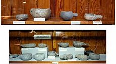 25/07/2022 - Steatite Vessels
These stone vessels, many with handles, were found at a variety of sites in Sutherland and... More >>