Picture the Past Dornoch to Tain
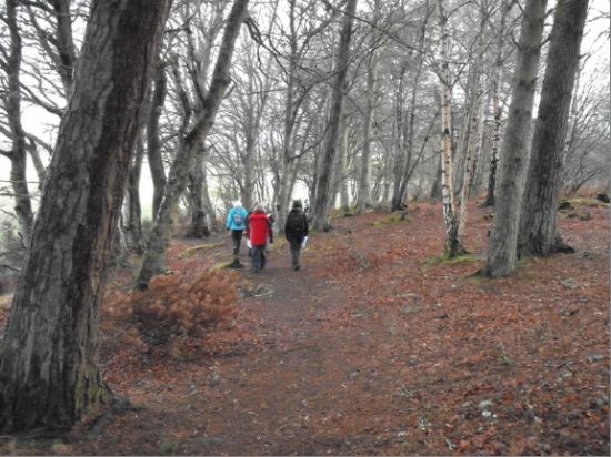 The coastline between Dornoch and Tain is an area which has been used for over 8000 years by people. In early 2011 ARCH ran a series of guided walks looking at the local heritage of Tain, Dornoch and Camore Woods. A variety of archaeological sites were photographed ranging from prehistoric hut circles to Tain Collegiate Church. Throughout the guided walks there was an effort to demonstrate how sea level change has affected the area over thousands of years. Issues of erosion, longshore drift and the rise and fall of the sea were discussed in relation to their effect on archaeological sites. Throughout the walk photos were taken of the sites to help update the heritage records for the area and provide a much need record of the present condition of the archaeological sites.
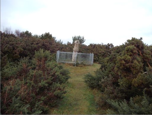
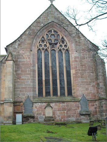
Earls Cross Stone, Dornoch Tain Collegiate Church


Earls Cross House, Dornoch Participants Checking the Records

General View of North Street Buildings, Dornoch
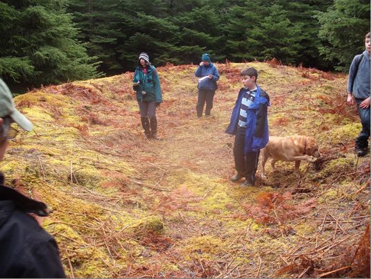
Hut Circle, Camore Woods
The project was very successful, involving thirty-one people from the communities of Dornoch, Tain and further afield. Over 100 new photographs of sites were taken.
A temporary display of the best photos toured Dornoch and Tain Libraries in spring 2011.
Many thanks to the Moray Firth Partnership, Highland Council, and the BBC for the funding for this project and to all the local community members who got involved despite the bad weather!
Latest News...
15/07/2026 - ARCH Digitising Highland Maps and Plans project - volunteers wanted!
Welcome Claire Boardman, our newly appointed project officer for the Digitish Highland Map... More >>
10/06/2026 - Wanted: project officer for ARCH Digitising Highland Maps and Plans project
ARCH is looking to recruit a project officer for The Digitisng Highland Maps and Plans pro... More >>
27/01/2026 - Highland Heritage Day 2026 - Booking form and timetable available
This year's Highland Heritage Day will take place on Saturday 14th March at Dingwall A... More >>
Site of the Month
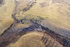 10/04/2021 - Easter Raitts township
Easter Raitts township Photo: Highland HER Although the Highlands is dotted with de... More >>
Find of the Month
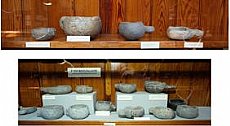 25/07/2022 - Steatite Vessels
These stone vessels, many with handles, were found at a variety of sites in Sutherland and... More >>