Pathways into the Past: Evanton
The section of the routeway running from Mountgerald to east of Evanton was examined by the community of Evanton. We were looking for remains of the routeway or sites that might have been associated with the routeway through the periods of its use. From the research done so far it looks possible that the routeway may be medieval or earlier in origin but more work needs to take place before this can be confirmed.
Sites we looked at included:
Cup Marked Stones, examples at Lemlair (MHG 8956)and Cnoc an Teampuill (MHG30199). These are interesting early prehistoric stones with cup mark decorations on them. Both these examples have been moved from their original location. They are enigmatic but though to be an important part of Neolithic society.
Visiting the cupmark stone at Cnoc an Teampuill
Tallysow Placename: On the site of the one time Novar Inn, this placename implies an area where servants of the Novar Estate were housed. Alternatively this placename is also thought to be connected with a place where soldiers billet ('tillet les soulds'), perhaps used when military forces were traveling on the routeways through the area.
Cawkers Road Placename: (An Cadh Ceard) Ceard = a tinsmith or tinker. A stretch of road branching off Old Evanton Road to Culnaskeath/Blackhill.
(For more information on these placenames see Watson WJ. Placenames of Easter Ross and Cromarty)
Cnoc an Teampuill: A stone covered mound lying along the line of the routeway. It is in a cultivated field known as Churchyard Field but there is no record of a chapel existing at this site. Covered by modern clearance it is hard to determine if this was a possibly medieval site associated with the routeway, a chambered cairn or something else! (MHG8957)
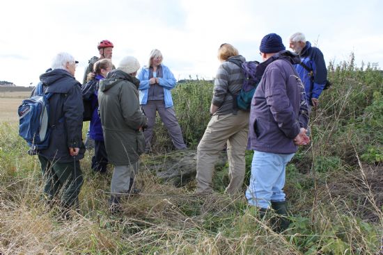
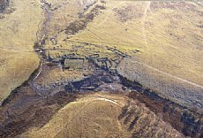
Possible motte at Foulis: A low flat topped mound in the grounds of Foulis Estate (only about 300m from Cnoc an Teampuill). This site overlooks a river crossing and lies on the predicted line of the routeway. Until recently it was covered with thick vegetation and hard to characterise but a more recent plane table survey by NOSAS indicates it could well be a possible motte site or at the very least a man made mound. (MHG8945)
Possible motte from the south
Churches and Chapels: A large number of church and chapel sites are found in this area, in particular the line of coastal sites such as Kiltearn Old Parish Church (MHG31395) and Cille Bhrea (MHG8942) follow a possible low level route through Easter Ross to Tain.
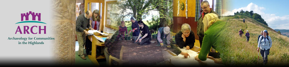
Bridges: We looked at the placement of the modern bridges crossing the rivers around Evanton and tried to identify where older bridges and crossing points would have been.
Mountgerald House and Mains, a fairly recent and renovated structure on a site that has been built on from at least the 16th century. (MHG22431)
Subsequent routes and roads around Evanton that may have been built over parts of older routes. In particular we looked at the Parliamentary Roads and how these were built.
The group also looked at evidence of sites/structures associated with these later roads such as a Milestone now moved to opposite the Cornerstone Cafe and the Foulis Gate Pillars (MHG16060) which linked the Parliamentary road and Foulis Castle in the 1800's. These have since been moved to their present position on the Foulis Estate.
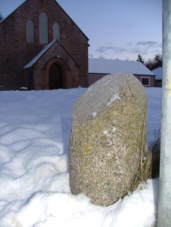
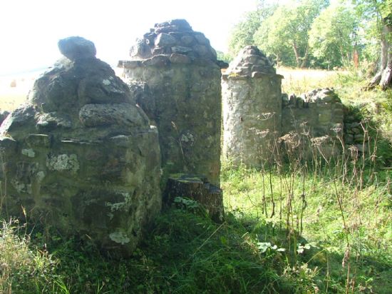
Milestone Gate Pillars
The display was researched and prepared by Linda Bain, Margaret Brown, Stuart Brown, Adrian Clark, Christine and Ian Hammond, Catherine Inkson, Alan Kinghorn, Linda Lamb, Alpin MacDonald, Mark Roscrow, Mark Stevens and Eddie Szymborski.
Latest News...
15/07/2026 - ARCH Digitising Highland Maps and Plans project - volunteers wanted!
Welcome Claire Boardman, our newly appointed project officer for the Digitish Highland Map... More >>
10/06/2026 - Wanted: project officer for ARCH Digitising Highland Maps and Plans project
ARCH is looking to recruit a project officer for The Digitisng Highland Maps and Plans pro... More >>
27/01/2026 - Highland Heritage Day 2026 - Booking form and timetable available
This year's Highland Heritage Day will take place on Saturday 14th March at Dingwall A... More >>
Site of the Month
 10/04/2021 - Easter Raitts township
Easter Raitts township Photo: Highland HER Although the Highlands is dotted with de... More >>
Find of the Month
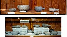 25/07/2022 - Steatite Vessels
These stone vessels, many with handles, were found at a variety of sites in Sutherland and... More >>